
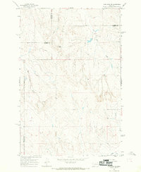
1969 Map of Horse Creek Hill
USGS Topo · Published 1973About this map
Horse Creek Hill rises as a prominent landmark in this eastern Montana landscape, anchoring a complex system of drainage basins that define the local geography in the late 1960s. The area is characterized by its intermittent watercourses, including Muster Creek and Sand Creek, which carve deep patterns through the terrain. Evidence of ranching and land management is visible through the notation of numerous wells and the presence of Clevenger Spring, vital water sources in this arid environment. Transportation through the hills is largely restricted to routes like Deadman Road, while the map also tracks the winding paths of Thompson Creek and Alkali Creek. This 1969 survey provides a precise record of fence lines and water improvements, offering a clear picture of the land's utility and the sparse network of rural infrastructure in Custer County.
Find a feature on this map
10 named features on this map. Tap any name to fly to it.
Don’t see what you’re looking for? This feature index may not catch every label — zoom into the map to look around manually.
Map Details
Editions of this 1969 Horse Creek Hill Map
This is the sole edition of this map. No revisions or reprints were ever made.
Other maps of this area

1953 · Miles City
USGS Topo · 1:250,000

1954 · Forsyth
USGS Topo · 1:250,000

1957 · Miles City
USGS Topo · 1:250,000

1957 · Forsyth
USGS Topo · 1:250,000

1958 · Miles City
USGS Topo · 1:250,000

1958 · Forsyth
USGS Topo · 1:250,000

1965 · Twin Buttes School
USGS Topo · 1:24,000

1965 · Morehouse Creek
USGS Topo · 1:24,000
1965 · Crow Rock SE
USGS Topo · 1:24,000

1969 · Noble Reservoir
USGS Topo · 1:24,000