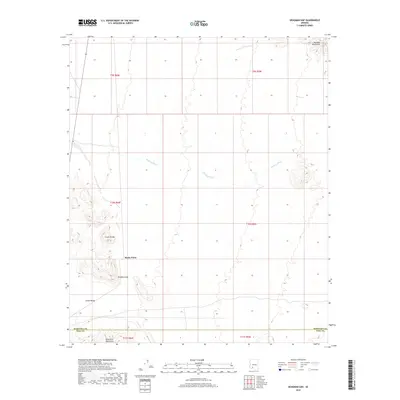
2018 Map of Deadman Gap
USGS Topo · Published 2018About this map
Rocky Point and Deadman Gap define the central topography of this Sonoran Desert landscape, where the Crater Range meets the expansive Childs Valley. The area is characterized by significant volcanic and tectonic landforms, including the southern reaches of the Sauceda Mountains in the northeast and the Batamote Mountains rising along the southern boundary. Drainage for the region is primarily channeled through the winding path of Midway Wash, which cuts across the arid plains. This 2018 survey documents the border region between Maricopa and Pima counties, illustrating the stark natural boundaries and the land-use divisions within the township and range system. The map provides a clear record of the intersection between these prominent mountain ranges and the low-lying desert washes that dictate the flow of seasonal water in this uninhabited stretch of Southern Arizona.
Find a feature on this map
14 named features on this map. Tap any name to fly to it.
Don’t see what you’re looking for? This feature index may not catch every label — zoom into the map to look around manually.
Map Details
Editions of this 2018 Deadman Gap Map
This is the sole edition of this map. No revisions or reprints were ever made.
Other maps of this area

1932 · Ajo
USGS Topo · 1:62,500

1934 · Ajo
USGS Topo · 1:62,500

1953 · Ajo
USGS Topo · 1:250,000

1957 · Ajo
USGS Topo · 1:250,000

1958 · Ajo
USGS Topo · 1:250,000

1958 · Midway
USGS Topo · 1:62,500

1958 · Hat Mountain
USGS Topo · 1:62,500

1962 · Ajo
USGS Topo · 1:250,000

1963 · Ajo
USGS Topo · 1:250,000

1963 · Ajo
USGS Topo · 1:62,500