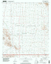
1996 Map of Deadman Gap
USGS Topo · Published 2000About this map
The Barry M Goldwater Air Force Range dominates this desert landscape, where military administration and natural geology converge in western Maricopa County. This late-twentieth-century survey documents a land defined by its dry washes and dramatic relief, centered on the topographic notch of Deadman Gap. The presence of Midway, situated along Midway Wash, suggests the strategic importance of this corridor between the Crater Range and the Sauceda Mountains. Evidence of human activity is sparse but telling, with scattered labels for a Corral, a Well, and White Tank indicating the fundamental role of water management in Childs Valley. The southern edge of the sheet is defined by the Maricopa Co Pima Co line, which follows the Military Reservation Boundary through the rugged volcanic terrain of the Sonoran Desert.
Find a feature on this map
16 named features on this map. Tap any name to fly to it.
Don’t see what you’re looking for? This feature index may not catch every label — zoom into the map to look around manually.
Map Details
Editions of this 1996 Deadman Gap Map
This is the sole edition of this map. No revisions or reprints were ever made.
Other maps of this area

1932 · Ajo
USGS Topo · 1:62,500

1934 · Ajo
USGS Topo · 1:62,500

1953 · Ajo
USGS Topo · 1:250,000

1957 · Ajo
USGS Topo · 1:250,000

1958 · Ajo
USGS Topo · 1:250,000

1958 · Midway
USGS Topo · 1:62,500

1958 · Hat Mountain
USGS Topo · 1:62,500

1962 · Ajo
USGS Topo · 1:250,000

1963 · Ajo
USGS Topo · 1:250,000

1963 · Ajo
USGS Topo · 1:62,500