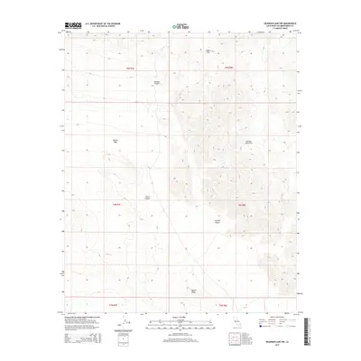
2015 Map of Deadman Lake NW
USGS Topo · Published 2015About this map
The Bullion Mountains dominate this arid landscape within the Mojave Desert, where steep slopes give way to the broad alluvial fans of the basin. The 2015 survey reveals a complex network of geological features, including the prominent drainage of Bullion Wash and the winding paths of Rainbow Canyon and Wood Canyon. These canyons and washes represent the primary hydrological conduits of the region, carrying runoff from the higher elevations down to the desert floor.
Find a feature on this map
13 named features on this map. Tap any name to fly to it.
Don’t see what you’re looking for? This feature index may not catch every label — zoom into the map to look around manually.
Map Details
Editions of this 2015 Deadman Lake NW Map
This is the sole edition of this map. No revisions or reprints were ever made.
Other maps of this area

1953 · San Bernardino
USGS Topo · 1:250,000

1954 · Hidalgo Mtn
USGS Topo · 1:24,000

1954 · Ludlow SE
USGS Topo · 1:24,000

1955 · Deadman Lake NW
USGS Topo · 1:24,000

1955 · Lavic SE
USGS Topo · 1:24,000

1955 · Goat Mountain
USGS Topo · 1:24,000

1955 · Morgans Well
USGS Topo · 1:24,000

1955 · Deadman Lake SE
USGS Topo · 1:24,000

1955 · Deadman Lake NE
USGS Topo · 1:24,000

1955 · Deadman Lake SW
USGS Topo · 1:24,000