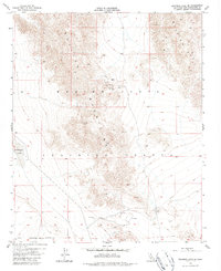
1955 Map of Deadman Lake SE
USGS Topo · Published 1987About this map
The Bullion Mountains dominate the landscape of this high desert region within the Marine Corps Training Center. The 1950s terrain is marked by intense military activity and rugged geographical markers, including the high point at VABM Segundo 3463 and a designated Rifle Range in the southern flats. A network of Jeep Trails provides the only access through the steep contours and desert washes, connecting remote mining sites labeled as Prospects and a Prospect tucked into the mountain folds.
Find a feature on this map
12 named features on this map. Tap any name to fly to it.
Don’t see what you’re looking for? This feature index may not catch every label — zoom into the map to look around manually.
Map Details
Editions of this 1955 Deadman Lake SE Map
5 editions found
Other maps of this area

1942 · Amboy
USGS Topo · 1:250,000

1943 · Amboy
USGS Topo · 1:250,000

1953 · San Bernardino
USGS Topo · 1:250,000

1954 · Needles
USGS Topo · 1:250,000

1954 · Valley Mtn
USGS Topo · 1:24,000

1955 · Deadman Lake NW
USGS Topo · 1:24,000

1955 · Lead Mountain
USGS Topo · 1:24,000

1955 · Deadman Lake SE
USGS Topo · 1:24,000

1955 · Deadman Lake NE
USGS Topo · 1:24,000

1955 · Deadman Lake SW
USGS Topo · 1:24,000