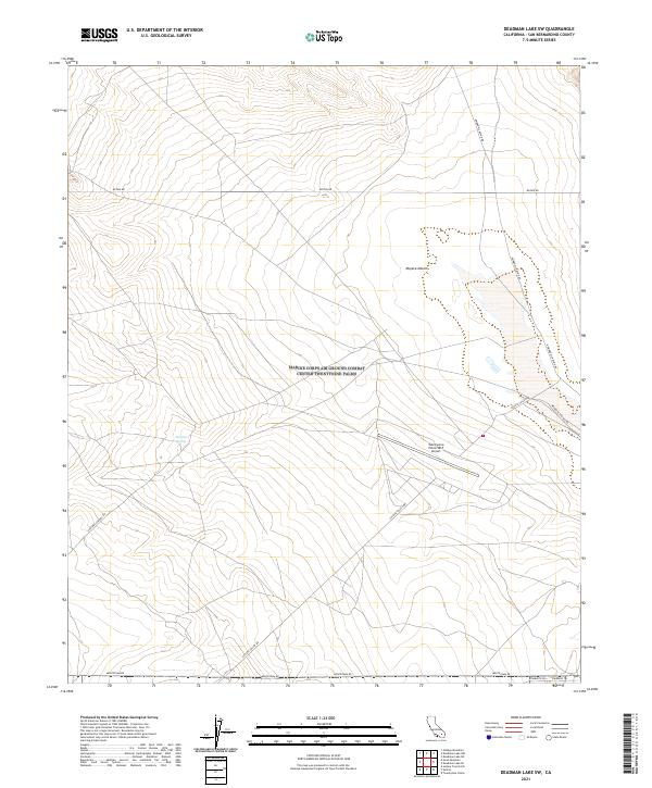
2021 Map of Deadman Lake SW
USGS Topo · Published 2021About this map
The Mojave Desert terrain of San Bernardino County is revealed in this 2021 study, characterized by a sparse network of tracks and roads across a landscape defined by water and aviation needs. The Twentynine Palms SELF Airport serves as a modern landmark in the eastern portion of the sheet, while the presence of Surprise Spring highlights the critical location of natural water sources in this arid environment. Roads like Surprise Springs Rd and Coyote Valley Rd trace the paths through the basin, connecting various township boundaries. The map illustrates how transportation routes such as Montezuma Rd and Botkin Rd skirt the edges of the canyon systems, providing a clear record of the area's contemporary land management and desert navigation.
Find a feature on this map
16 named features on this map. Tap any name to fly to it.
Don’t see what you’re looking for? This feature index may not catch every label — zoom into the map to look around manually.
Map Details
Editions of this 2021 Deadman Lake SW Map
This is the sole edition of this map. No revisions or reprints were ever made.
Other maps of this area

1953 · San Bernardino
USGS Topo · 1:250,000

1954 · Hidalgo Mtn
USGS Topo · 1:24,000

1955 · Deadman Lake NW
USGS Topo · 1:24,000

1955 · Goat Mountain
USGS Topo · 1:24,000

1955 · Deadman Lake SE
USGS Topo · 1:24,000

1955 · Deadman Lake NE
USGS Topo · 1:24,000

1955 · Deadman Lake SW
USGS Topo · 1:24,000

1955 · Twentynine Palms
USGS Topo · 1:24,000

1955 · Twentynine Palms
USGS Topo · 1:62,500

1955 · Emerson Lake
USGS Topo · 1:62,500