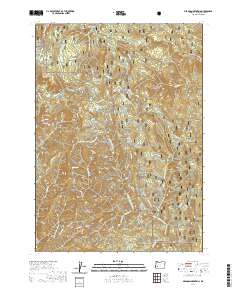
2020 Map of Deadman Mountain
USGS Topo · Published 2020About this map
Umpqua National Forest defines this high-elevation landscape in Douglas County, dominated by the prominent peaks of Deadman Mtn and Tater Hill. The drainage patterns are clearly visible as they feed into the S Myrtle Cr and Deadman Cr systems. An intricate network of Forest Service and BLM roads, including Deadman Creek Rd and Nat For Dev Rd 2810, provides access to these timbered slopes. Notable water sources such as Cultus Lake, Red Top Spring, and Johnnie Springs are scattered throughout the terrain, reflecting the area's hydrology. The presence of the Red Top Spring Helipond and specialized management areas like Deer Springs Thinning highlights the active land management practices in this part of the Cascades. To the southeast, the topography descends toward Texas Gulch, while Smith Ridge marks the northeastern extent of the survey.
Find a feature on this map
74 named features on this map. Tap any name to fly to it.
Don’t see what you’re looking for? This feature index may not catch every label — zoom into the map to look around manually.
Map Details
Editions of this 2020 Deadman Mountain Map
This is the sole edition of this map. No revisions or reprints were ever made.
Other maps of this area

1891 · Ashland
USGS Topo · 1:250,000

1893 · Ashland
USGS Topo · 1:250,000

1897 · Roseburg
USGS Topo · 1:125,000

1897 · Ashland
USGS Topo · 1:250,000

1900 · Roseburg
USGS Topo · 1:125,000

1904 · Riddle
USGS Topo · 1:125,000

1944 · Tiller
USGS Topo · 1:62,500

1954 · Dixonville
USGS Topo · 1:62,500

1954 · Days Creek
USGS Topo · 1:62,500

1955 · Red Butte
USGS Topo · 1:62,500