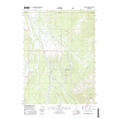
2017 Map of Deadman Mountain
USGS Topo · Published 2017About this map
Wasatch National Forest occupies the southern and eastern reaches of this high-altitude landscape where the headwaters of the Bear River carve through the borderlands of Utah and Wyoming. This 2017 survey details a sophisticated network of early water management infrastructure, including the Hilliard Canal, Hilliard E Fork Canal, and Lannon Ditch, which redirect water across the complex drainage basins below Lone Mtn. The terrain is characterized by a mix of high peaks and marshy depressions, such as Lily Lake and Grassy Lake, which sit amidst a grid of modern forestry roads and recreational trails. Seasonal access routes like the Lily Lake Snow Machine and various Wolverine ATV trails highlight the area's contemporary use as a recreational corridor, while the prominent peak of Deadman Mountain anchors the southeastern corner of the quadrangle.
Find a feature on this map
44 named features on this map. Tap any name to fly to it.
Don’t see what you’re looking for? This feature index may not catch every label — zoom into the map to look around manually.
Map Details
Editions of this 2017 Deadman Mountain Map
This is the sole edition of this map. No revisions or reprints were ever made.
Other maps of this area

1885 · Uinta
USGS Topo · 1:250,000

1901 · Hayden Peak
USGS Topo · 1:125,000

1903 · Hayden Peak
USGS Topo · 1:125,000

1954 · Salt Lake City
USGS Topo · 1:250,000

1954 · Ogden
USGS Topo · 1:250,000

1958 · Ogden
USGS Topo · 1:250,000

1958 · Salt Lake City
USGS Topo · 1:250,000

1960 · Ogden
USGS Topo · 1:250,000

1960 · Salt Lake City
USGS Topo · 1:250,000

1965 · Myers Reservoir
USGS Topo · 1:24,000