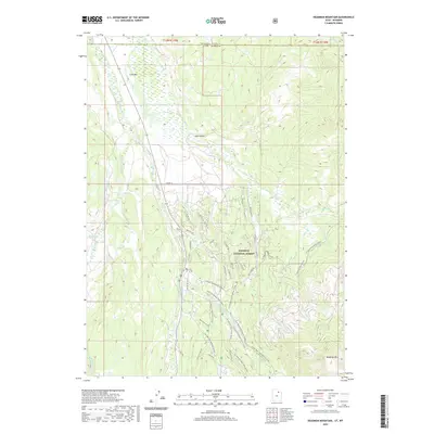
2020 Map of Deadman Mountain
USGS Topo · Published 2020About this map
The Wasatch National Forest dominates this high-altitude landscape where the headwaters of the Bear River and W Fork Bear River gather. This area, straddling the border between Summit County, Utah and Uinta County, Wyoming, is defined by its recreational and hydrological significance. Seasonal access is highlighted by an extensive network of specialized routes, including the Canal Snowmobile Trail, Lily Lake Snow Machine tracks, and various Wolverine ATV trails. The terrain rises to prominent peaks like Deadman Mtn and Lone Mtn, while the Hill Afb Camp Nature suggests the region's long-standing use for organized outdoor retreats. The presence of numerous small water bodies, such as Grassy Lakes and Lily Lake, alongside creeks like Mill Cr and Christmas Tree Cr, reveals a complex watershed managed for both drainage and recreation.
Find a feature on this map
47 named features on this map. Tap any name to fly to it.
Don’t see what you’re looking for? This feature index may not catch every label — zoom into the map to look around manually.
Map Details
Editions of this 2020 Deadman Mountain Map
This is the sole edition of this map. No revisions or reprints were ever made.
Other maps of this area

1885 · Uinta
USGS Topo · 1:250,000

1901 · Hayden Peak
USGS Topo · 1:125,000

1903 · Hayden Peak
USGS Topo · 1:125,000

1954 · Salt Lake City
USGS Topo · 1:250,000

1954 · Ogden
USGS Topo · 1:250,000

1958 · Ogden
USGS Topo · 1:250,000

1958 · Salt Lake City
USGS Topo · 1:250,000

1960 · Ogden
USGS Topo · 1:250,000

1960 · Salt Lake City
USGS Topo · 1:250,000

1965 · Myers Reservoir
USGS Topo · 1:24,000