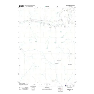
2012 Map of Deadman Peak
USGS Topo · Published 2012About this map
Deadman Peak stands at the center of this high-elevation landscape where the drainages of the E Fork S Fork Salmon River and S Fork Scott River converge. The terrain is defined by a dense network of gulches and meadows, including Carter Meadow and Onion Meadow, which historically supported seasonal grazing and early mountain travel. Evidence of human presence is found at the Schlomberg Cabin and Trail Creek Campground, linked by a network of forest routes such as Forest Rte 39N20. Numerous glacial features are scattered across the peaks, including Trail Gulch Lake, Rush Creek Lake, and Little Jackson Lake, marking the headwaters of vital regional waterways. The map illustrates the 2012 state of this protected backcountry, where traditional place names like Dog Paw Gulch and Snowslide Gulch speak to the physical challenges faced by early explorers and survey parties.
Find a feature on this map
48 named features on this map. Tap any name to fly to it.
Don’t see what you’re looking for? This feature index may not catch every label — zoom into the map to look around manually.
Map Details
Editions of this 2012 Deadman Peak Map
This is the sole edition of this map. No revisions or reprints were ever made.
Other maps of this area

1886 · Shasta
USGS Topo · 1:250,000

1894 · Shasta
USGS Topo · 1:250,000

1923 · Sawyers Bar
USGS Topo · 1:125,000

1931 · Etna
USGS Topo · 1:96,000

1934 · Etna
USGS Topo · 1:125,000

1948 · Weed
USGS Topo · 1:250,000

1950 · Weed
USGS Topo · 1:250,000

1955 · Cecilville
USGS Topo · 1:62,500

1955 · Sawyers Bar
USGS Topo · 1:62,500

1955 · Etna
USGS Topo · 1:62,500