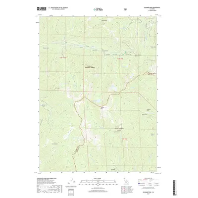
2018 Map of Deadman Peak
USGS Topo · Published 2018About this map
Deadman Peak stands as a central landmark in this high-altitude landscape where the Klamath National Forest meets the Shasta-National Forest. The terrain is defined by a dense network of glacial basins and alpine meadows, including Carter Meadow, Lees Meadow, and Onion Meadow, which historically served as vital summer grazing grounds. This area within the Salmon Mountains is a significant hydrological hub, feeding numerous tributaries such as the E Fork S Fork Salmon River, Coffee Cr, and S Fork Scott River. A segment of the Pacific Crest National Scenic Trail winds through the northern portion of the map, tracing the high ridges above Little Jackson Lake and Hidden Lake. The distribution of family-named features like Joe Keen Meadows and various gulches such as Daley Gulch and Noland Gulch points to the region's history of small-scale mining and early ranching efforts.
Find a feature on this map
57 named features on this map. Tap any name to fly to it.
Don’t see what you’re looking for? This feature index may not catch every label — zoom into the map to look around manually.
Map Details
Editions of this 2018 Deadman Peak Map
This is the sole edition of this map. No revisions or reprints were ever made.
Other maps of this area

1886 · Shasta
USGS Topo · 1:250,000

1894 · Shasta
USGS Topo · 1:250,000

1923 · Sawyers Bar
USGS Topo · 1:125,000

1931 · Etna
USGS Topo · 1:96,000

1934 · Etna
USGS Topo · 1:125,000

1948 · Weed
USGS Topo · 1:250,000

1950 · Weed
USGS Topo · 1:250,000

1955 · Cecilville
USGS Topo · 1:62,500

1955 · Sawyers Bar
USGS Topo · 1:62,500

1955 · Etna
USGS Topo · 1:62,500