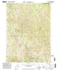
2001 Map of Deadman Point
USGS Topo · Published 2004About this map
Klamath National Forest dominates this section of the Siskiyou Mountains, straddling the high border between California and Oregon. The landscape is defined by the steep drainage basins of Indian Creek and its tributaries, including the East Fork and South Fork. Resource extraction and navigation in this steep terrain are evidenced by the presence of the Wood Mine, Huey Mine, and Jane Mine, alongside the winding path of Grayback Road. Notable elevations such as Spees Peak and Bare Mountain offer landmarks across the Thompson Ridge and Mill Creek Ridge formations. This 2001 revision illustrates the complex topography of the Siskiyou County backcountry, where small-scale mining operations and forest service routes represent the primary human imprint on the land.
Find a feature on this map
28 named features on this map. Tap any name to fly to it.
Don’t see what you’re looking for? This feature index may not catch every label — zoom into the map to look around manually.
Map Details
Editions of this 2001 Deadman Point Map
2 editions found
Other maps of this area

1908 · Grants Pass
USGS Topo · 1:125,000

1914 · Seiad
USGS Topo · 1:125,000

1917 · Kerby
USGS Topo · 1:125,000

1918 · Kerby
USGS Topo · 1:125,000

1922 · Preston Peak
USGS Topo · 1:125,000

1922 · Seiad
USGS Topo · 1:125,000

1945 · Kerby
USGS Topo · 1:125,000

1948 · Weed
USGS Topo · 1:250,000

1950 · Weed
USGS Topo · 1:250,000

1954 · Cave Junction
USGS Topo · 1:62,500