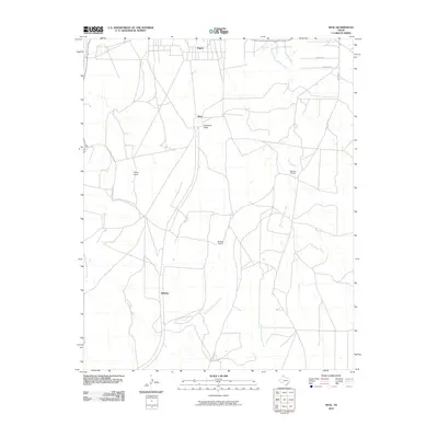
2010 Map of Deal
USGS Topo · Published 2010About this map
Antelope Peak stands as a central topographic landmark in this section of the Texas Panhandle, overlooking a landscape defined by expansive ranching operations and winding creek beds. The northern edge of the map includes the southern portion of Fritch, while smaller namesake settlements and outposts like Deal and Wilhelm anchor the interior. The drainage network of Antelope Creek is highly visible, including the convergence of the West Fork Antelope Creek and East Fork Antelope Creek as they cut through the terrain. Evidence of the region’s long-standing agricultural and land-management traditions is found in the scattered ranch properties, specifically Poling Ranch, Sanford Ranch, and Bennett Ranch, which mark the rural sections between the primary roads like Sunset Rd and Cherokee Rd.
Find a feature on this map
15 named features on this map. Tap any name to fly to it.
Don’t see what you’re looking for? This feature index may not catch every label — zoom into the map to look around manually.
Map Details
Editions of this 2010 Deal Map
This is the sole edition of this map. No revisions or reprints were ever made.
Other maps of this area

1939 · Sanford
USGS Topo · 1:62,500

1953 · Sanford
USGS Topo · 1:24,000

1953 · Alibates Ranch
USGS Topo · 1:24,000

1953 · Evans Canyon
USGS Topo · 1:24,000

1953 · Deal
USGS Topo · 1:24,000

1953 · Pomeroy
USGS Topo · 1:24,000

1953 · McBride
USGS Topo · 1:24,000

1953 · Berry Sand Draw
USGS Topo · 1:24,000

1953 · Borger
USGS Topo · 1:24,000

1954 · Amarillo
USGS Topo · 1:250,000