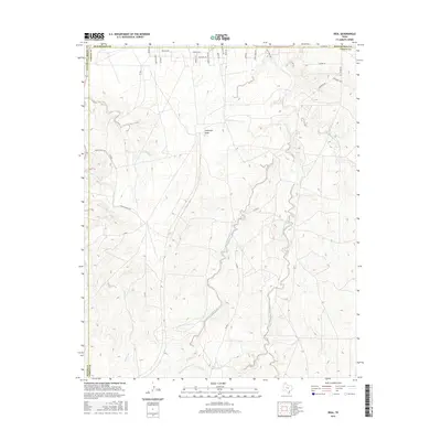
2016 Map of Deal
USGS Topo · Published 2016About this map
Antelope Peak stands as a prominent landmark in this Texas Panhandle landscape where the borders of Carson, Potter, Moore, and Hutchinson counties converge. The terrain is defined by the complex drainage systems of West Fork Antelope Creek and East Fork Antelope Creek, which carve deep contours into the high plains. Cultural history is etched into the modern road network, with local thoroughfares echoing the names of historic migration routes such as the Chisolm Trl, Santa Fe Trl, and Cherokee Trl. These labels suggest a landscape shaped by long-standing cattle and trade corridors. To the east, the curious label Seven Holes indicates a specific natural or man-made hydrology feature. The map further documents the rural infrastructure of ranching life, from Poling Ranch Rd to the more recent residential naming conventions seen in Arroyo Verde Dr and Sage Mesa Dr.
Find a feature on this map
35 named features on this map. Tap any name to fly to it.
Don’t see what you’re looking for? This feature index may not catch every label — zoom into the map to look around manually.
Map Details
Editions of this 2016 Deal Map
This is the sole edition of this map. No revisions or reprints were ever made.
Other maps of this area

1939 · Sanford
USGS Topo · 1:62,500

1953 · Sanford
USGS Topo · 1:24,000

1953 · Alibates Ranch
USGS Topo · 1:24,000

1953 · Evans Canyon
USGS Topo · 1:24,000

1953 · Deal
USGS Topo · 1:24,000

1953 · Pomeroy
USGS Topo · 1:24,000

1953 · McBride
USGS Topo · 1:24,000

1953 · Berry Sand Draw
USGS Topo · 1:24,000

1953 · Borger
USGS Topo · 1:24,000

1954 · Amarillo
USGS Topo · 1:250,000