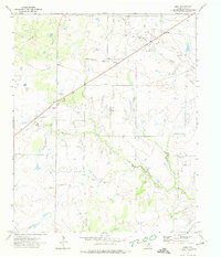
1972 Map of Dean
USGS Topo · Published 1974About this map
The Petrolia Oil Field dominates the northeastern landscape of this Clay County region, where the energy industry is marked by numerous Oil Wells and a network of pipelines crossing the terrain. Small rural communities like Dean and Jolly serve as the primary hubs for local activity, with an Athletic Field situated in the heart of Dean near the intersection of local roads.
Find a feature on this map
12 named features on this map. Tap any name to fly to it.
Don’t see what you’re looking for? This feature index may not catch every label — zoom into the map to look around manually.
Map Details
Editions of this 1972 Dean Map
This is the sole edition of this map. No revisions or reprints were ever made.
Other maps of this area

1954 · Wichita Falls
USGS Topo · 1:250,000

1955 · Lawton
USGS Topo · 1:250,000

1956 · Sloop Creek
USGS Topo · 1:24,000

1956 · Henrietta
USGS Topo · 1:62,500

1957 · Hastings
USGS Topo · 1:62,500

1957 · Randlett
USGS Topo · 1:62,500

1957 · Wichita Falls East
USGS Topo · 1:62,500

1957 · Wichita Falls East
USGS Topo · 1:24,000

1958 · Wichita Falls
USGS Topo · 1:250,000
1972 · Thornberry
USGS Topo · 1:24,000