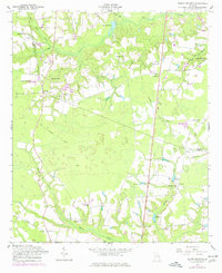
1958 Map of Deans Crossing
USGS Topo · Published 1977About this map
Beards Creek and Bull Creek define the low-lying terrain of Tattnall and Evans counties in this mid-century portrait of rural Georgia. The landscape is dotted with small family-named landmarks and local centers of worship, including Mt Zion Ch, Bay Branch Ch, and Smyrna Ch. Small-scale agricultural and homesteading patterns are evident through numerous scattered ponds like Collins Pond and Daniels Pond, alongside several small burial grounds such as Hammock Cem and Smith Cem.
Find a feature on this map
40 named features on this map. Tap any name to fly to it.
Don’t see what you’re looking for? This feature index may not catch every label — zoom into the map to look around manually.
Map Details
Editions of this 1958 Deans Crossing Map
3 editions found
Other maps of this area

1919 · Claxton
USGS Topo · 1:62,500

1920 · Glennville
USGS Topo · 1:62,500

1944 · Claxton
USGS Topo · 1:62,500

1944 · Glennville
USGS Topo · 1:62,500

1946 · Brunswick
USGS Topo · 1:250,000

1947 · Savannah
USGS Topo · 1:250,000

1948 · Brunswick
USGS Topo · 1:250,000

1948 · Savannah
USGS Topo · 1:250,000

1950 · Glennville
USGS Topo · 1:62,500

1950 · Claxton
USGS Topo · 1:62,500