1970 Map of Reidsville West
USGS Topo · Published 1987About this map
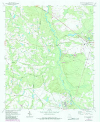
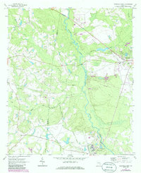
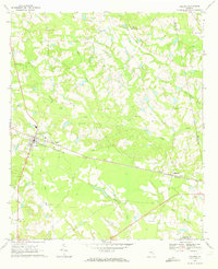
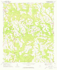
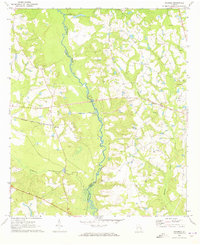
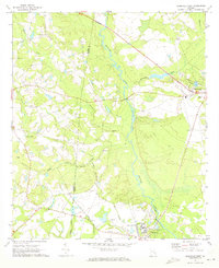
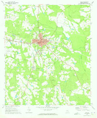
The Ohoopee River defines the landscape of western Tattnall County, winding through a network of wetlands and tributaries like Watson Creek and Brazells Creek. This mid-century survey illustrates a region largely shaped by the extensive Prison Boundary, which encompasses a significant portion of the terrain south of Reidsville. Within these lands, the State Prison complex stands as a major landmark, complete with its own Landing Strip, radio tower, and agricultural infrastructure. Beyond the institutional grounds, the area retains a rural character anchored by small hubs like Stanleys Store and a collection of country churches including Mt Moriah Ch and Oak Grove Ch. Genealogists will find several family-named burial sites documented here, such as Cave Cem, Stanley Cem, and Ryals Cem, which reflect the long-standing community ties to the land near Gordonia Alatamaha State Park.
Find a feature on this map
30 named features on this map. Tap any name to fly to it.
Don’t see what you’re looking for? This feature index may not catch every label — zoom into the map to look around manually.
Map Details
Editions of this 1970 Reidsville West Map
Other maps of this area

1953 · Waycross
USGS Topo · 1:250,000

1957 · Macon
USGS Topo · 1:250,000

1958 · Macon
USGS Topo · 1:250,000

1958 · Waycross
USGS Topo · 1:250,000

1964 · Macon
USGS Topo · 1:250,000
1970 · Collins
USGS Topo · 1:24,000
1970 · Johnson Corner
USGS Topo · 1:24,000
1970 · Ohoopee
USGS Topo · 1:24,000
1970 · Reidsville West
USGS Topo · 1:24,000
1970 · Lyons
USGS Topo · 1:24,000