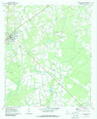
1970 Map of Reidsville East
USGS Topo · Published 1987About this map
Reidsville serves as the focal point for this Tattnall County landscape, where the town street grid meets the winding courses of Thomas Creek and Battle Creek. The 1970 field check reveals a community anchored by its rural institutions, with a dense concentration of family and church burial grounds such as Pine Grove Cem, Maddox Cem, and Wilds Cem. The landscape transitions from the developed edge of town, marked by the Lookout Tower, into the timber and agricultural lands of Hughland to the south.
Find a feature on this map
23 named features on this map. Tap any name to fly to it.
Don’t see what you’re looking for? This feature index may not catch every label — zoom into the map to look around manually.
Map Details
Editions of this 1970 Reidsville East Map
2 editions found
Other maps of this area

1919 · Claxton
USGS Topo · 1:62,500

1920 · Glennville
USGS Topo · 1:62,500

1944 · Claxton
USGS Topo · 1:62,500

1944 · Glennville
USGS Topo · 1:62,500

1946 · Brunswick
USGS Topo · 1:250,000

1947 · Savannah
USGS Topo · 1:250,000

1948 · Brunswick
USGS Topo · 1:250,000

1948 · Savannah
USGS Topo · 1:250,000

1950 · Glennville
USGS Topo · 1:62,500

1950 · Claxton
USGS Topo · 1:62,500