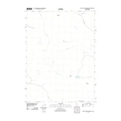
2011 Map of Death Creek Reservoir
USGS Topo · Published 2011About this map
White Rock Mountain and Burnt Mountain dominate this corner of Box Elder County, where high-desert drainage systems converge toward the Death Creek Reservoir. This 2011 survey documents a landscape of sparse human footprint, centered around Vals Camp and the winding course of Dean Pass Rd as it cuts through Morse Canyon. The hydrology of the region is defined by seasonal water sources like Bull Spring, Dinner Springs, and Toro Spring, which feed into various forks such as Bluff Creek and Mecham Creek. Notable topographic features including Death Valley and the Narrows of Dairy Valley illustrate the complex erosion patterns of the Utah-Nevada borderlands, providing a clear record of the area's natural landmarks and remote outposts used by ranchers and outdoorsmen in the early 21st century.
Find a feature on this map
23 named features on this map. Tap any name to fly to it.
Don’t see what you’re looking for? This feature index may not catch every label — zoom into the map to look around manually.
Map Details
Editions of this 2011 Death Creek Reservoir Map
This is the sole edition of this map. No revisions or reprints were ever made.
Other maps of this area

1954 · Brigham City
USGS Topo · 1:250,000

1955 · Wells
USGS Topo · 1:250,000

1958 · Wells
USGS Topo · 1:250,000

1958 · Brigham City
USGS Topo · 1:250,000

1959 · Cotton Thomas Basin
USGS Topo · 1:62,500

1961 · Wells
USGS Topo · 1:250,000

1961 · Goose Creek
USGS Topo · 1:62,500

1961 · Dairy Valley
USGS Topo · 1:62,500

1962 · Brigham City
USGS Topo · 1:250,000
1971 · Toms Cabin Spring
USGS Topo · 1:24,000