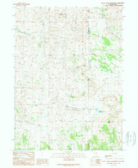
1989 Map of Death Creek Reservoir
USGS Topo · Published 1989About this map
Death Valley and the high desert terrain of the Great Basin dominate this 1980s topographic study, situated along the border of Utah and Nevada. The landscape is defined by its water sources, where named locations like Bull Spring, Toro Spring, and Dinner Springs provided essential stopping points in an arid environment. The map details a complex network of ephemeral drainages and creeks, including Mecham Creek and White Rock Creek, which flow toward the eastern slopes of White Rock Mountain.
Find a feature on this map
25 named features on this map. Tap any name to fly to it.
Don’t see what you’re looking for? This feature index may not catch every label — zoom into the map to look around manually.
Map Details
Editions of this 1989 Death Creek Reservoir Map
This is the sole edition of this map. No revisions or reprints were ever made.
Other maps of this area

1954 · Brigham City
USGS Topo · 1:250,000

1955 · Wells
USGS Topo · 1:250,000

1958 · Wells
USGS Topo · 1:250,000

1958 · Brigham City
USGS Topo · 1:250,000

1959 · Cotton Thomas Basin
USGS Topo · 1:62,500

1961 · Wells
USGS Topo · 1:250,000

1961 · Goose Creek
USGS Topo · 1:62,500

1961 · Dairy Valley
USGS Topo · 1:62,500

1962 · Brigham City
USGS Topo · 1:250,000
1971 · Toms Cabin Spring
USGS Topo · 1:24,000