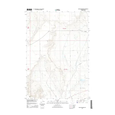
2015 Map of Deaver Reservoir
USGS Topo · Published 2015About this map
Frannie stands at the northeastern edge of this Wyoming landscape, where the high desert meets an intricate network of human-engineered irrigation. The Frannie Canal and Deaver Canal dominate the terrain, snaking across the contours to feed the arid lands surrounding Deaver Reservoir. This 2015 survey reveals how the local economy and geography are tied to these waterways, with a rigid grid of rural roads like 1st Ave and Lane 4 W providing access to the agricultural parcels between the hills. The prominent elevation of Polecat Bench rises to the west, while the historic route of the Jim Bridger Trl cuts through the southeastern corner. Smaller water bodies like Blue Lake and drainages such as Polecat Cr fill out the natural topography of this Park and Big Horn County border region.
Find a feature on this map
34 named features on this map. Tap any name to fly to it.
Don’t see what you’re looking for? This feature index may not catch every label — zoom into the map to look around manually.
Map Details
Editions of this 2015 Deaver Reservoir Map
This is the sole edition of this map. No revisions or reprints were ever made.
Other maps of this area

1954 · Billings
USGS Topo · 1:250,000

1955 · Cody
USGS Topo · 1:250,000

1957 · Billings
USGS Topo · 1:250,000

1958 · Billings
USGS Topo · 1:250,000

1958 · Cody
USGS Topo · 1:250,000

1962 · Cody
USGS Topo · 1:250,000

1966 · Frannie
USGS Topo · 1:24,000

1966 · Garland
USGS Topo · 1:24,000

1966 · Elk Basin
USGS Topo · 1:24,000

1966 · Deaver Reservoir
USGS Topo · 1:24,000