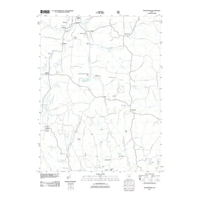
2011 Map of Deavertown
USGS Topo · Published 2011About this map
San Toy and Deavertown anchor this portion of the Perry County landscape, which is defined by a dense network of township roads and several distinct watercourses. The drainage patterns of Black Fork, Moxahala Creek, and Sunday Creek have historically shaped the settlement placement in this region. For genealogists, the map is a significant resource, documenting numerous local burial grounds including Iliff Cemetery, McCaslin Family Cemetery, and Shick Cemetery, which often sit adjacent to historical farmsteads. Smaller communities such as Rose Farm, Tropic, and Misco are clustered along the northern reaches, while the southern terrain rises toward Alabama Hill and Chapel Hill. Infrastructure such as the Crooksville Airport and San Toy Lake, created by the San Toy Dam, highlights the area's development and water management through the early 21st century.
Find a feature on this map
101 named features on this map. Tap any name to fly to it.
Don’t see what you’re looking for? This feature index may not catch every label — zoom into the map to look around manually.
Map Details
Editions of this 2011 Deavertown Map
This is the sole edition of this map. No revisions or reprints were ever made.
Other maps of this area

1910 · Philo
USGS Topo · 1:62,500

1910 · Zanesville
USGS Topo · 1:62,500

1910 · Mc Connelsville
USGS Topo · 1:62,500

1911 · New Lexington
USGS Topo · 1:62,500

1947 · Columbus
USGS Topo · 1:250,000

1949 · Clarksburg
USGS Topo · 1:250,000

1956 · Clarksburg
USGS Topo · 1:250,000

1961 · Columbus
USGS Topo · 1:250,000

1961 · Clarksburg
USGS Topo · 1:250,000

1961 · Corning
USGS Topo · 1:24,000