2023 Map of Deavertown
USGS Topo · Published 2023About this map
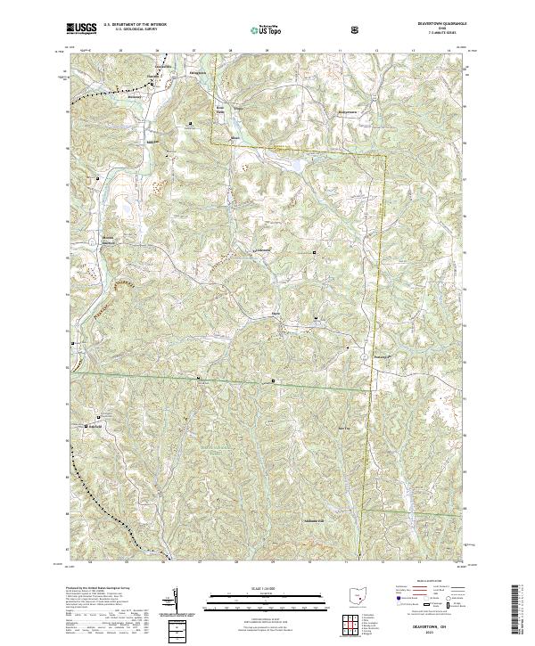
Moxahala Creek and its many tributaries, including McLuney Creek, define the landscape of this portion of Perry and Morgan counties. The map details a high density of rural cemeteries and family burial grounds such as McCaslin Family Cem, Shick Cem, and Iliff Cem, which are essential for genealogists tracing early families in the region. The southern half of the quadrangle is dominated by the Wayne National Forest, where the terrain rises toward Alabama Hill and the Wildcat Hollow Trail winds through the woodland. Smaller settlements like Sayre, Tropic, and San Toy appear alongside established towns like Crooksville. The map reflects a landscape shaped by both the natural drainage of the Sunday Creek system and the localized development of communities like Rose Farm and McLuney.
Find a feature on this map
66 named features on this map. Tap any name to fly to it.
Don’t see what you’re looking for? This feature index may not catch every label — zoom into the map to look around manually.
Map Details
Editions of this 2023 Deavertown Map
This is the sole edition of this map. No revisions or reprints were ever made.
Historical Maps of Misco Through Time
3 maps found