
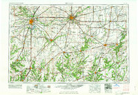
1961 Map of Decatur
USGS Topo · Published 1961About this map
Springfield and Decatur anchor this mid-century look at the Central Illinois prairie, a landscape defined by an exceptionally dense network of industrial and agricultural transportation. By the late 1950s, the region's rail-and-river economy remained in high relief, with the Wabash RR and Illinois Central RR cutting across the fertile plains to connect grain hubs like Taylorville, Pana, and Sullivan. The map captures the hydrological character of the area through the winding courses of the Sangamon River and Kaskaskia River, alongside major reservoirs including Lake Decatur and Lake Springfield. This era shows the transition toward modern automotive travel, as major routes like Us 66 and Us 51 intersect the older rail corridors. From the coal-mining towns of Macoupin County like Gillespie and Staunton to the industrial centers of Mattoon and Charleston, the sheet provides a comprehensive record of the region's mid-century physical and economic geography.
Find a feature on this map
210 named features on this map. Tap any name to fly to it.
Don’t see what you’re looking for? This feature index may not catch every label — zoom into the map to look around manually.
Map Details
Editions of this 1961 Decatur Map
2 editions found
Other maps of this area

1906 · Urbana
USGS Topo · 1:62,500

1907 · Springfield
USGS Topo · 1:62,500

1907 · Mahomet
USGS Topo · 1:62,500

1909 · Tallula
USGS Topo · 1:62,500

1910 · Hardinville
USGS Topo · 1:62,500

1911 · Lincoln
USGS Topo · 1:62,500

1912 · Gillespie
USGS Topo · 1:62,500

1913 · Lincoln
USGS Topo · 1:62,500

1915 · Gillespie
USGS Topo · 1:62,500

1915 · Mount Olive
USGS Topo · 1:62,500