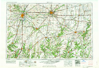
1961 Map of Decatur
USGS Topo · Published 1961About this map
The Springfield and Decatur corridors define the central Illinois prairie landscape in this early 1960s survey, showing a region where the industrial economy and state government intersect. Within the capital, landmark sites such as the Lincoln Home and the State Capitol are established alongside educational institutions like Millikin University and Eastern Illinois University. The map reveals a dense network of transit, where the Illinois Central, Wabash, and Pennsylvania railroads cross the agricultural heartland, connecting smaller hubs like Taylorville, Mattoon, and Effingham.
Find a feature on this map
106 named features on this map. Tap any name to fly to it.
Don’t see what you’re looking for? This feature index may not catch every label — zoom into the map to look around manually.
Map Details
Editions of this 1961 Decatur Map
2 editions found

Other maps of this area

1906 · Urbana
USGS Topo · 1:62,500

1907 · Springfield
USGS Topo · 1:62,500

1907 · Mahomet
USGS Topo · 1:62,500

1909 · Tallula
USGS Topo · 1:62,500

1910 · Hardinville
USGS Topo · 1:62,500

1911 · Lincoln
USGS Topo · 1:62,500

1912 · Gillespie
USGS Topo · 1:62,500

1913 · Lincoln
USGS Topo · 1:62,500

1915 · Gillespie
USGS Topo · 1:62,500

1915 · Mount Olive
USGS Topo · 1:62,500