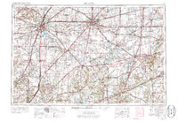
1958 Map of Decatur
USGS Topo · Published 1986About this map
Decatur serves as the central hub of this Central Illinois landscape, where the Sangamon River is harnessed to create Lake Decatur. The map reveals a highly structured agricultural and transportation grid, where traditional river paths like the Kaskaskia River and Embarras River intersect with the expanding postwar highway system. Major infrastructure developments are evident in the creation of the Shelbyville Reservoir and Lake Springfield, reflecting a mid-century focus on water management and recreation. Smaller, distinct settlements like Fancy Prairie, Williamsville, and Villa Grove are connected by a dense network of railroads including the Norfolk and Western and Illinois Central Gulf. This survey provides a clear view of the region as it transitioned toward modern connectivity while maintaining its foundational identity as a rail-dependent prairie heartland.
Find a feature on this map
109 named features on this map. Tap any name to fly to it.
Don’t see what you’re looking for? This feature index may not catch every label — zoom into the map to look around manually.
Map Details
Editions of this 1958 Decatur Map
3 editions found

Other maps of this area

1906 · Urbana
USGS Topo · 1:62,500

1907 · Springfield
USGS Topo · 1:62,500

1907 · Mahomet
USGS Topo · 1:62,500

1909 · Tallula
USGS Topo · 1:62,500

1910 · Hardinville
USGS Topo · 1:62,500

1911 · Lincoln
USGS Topo · 1:62,500

1912 · Gillespie
USGS Topo · 1:62,500

1913 · Lincoln
USGS Topo · 1:62,500

1915 · Gillespie
USGS Topo · 1:62,500

1915 · Mount Olive
USGS Topo · 1:62,500