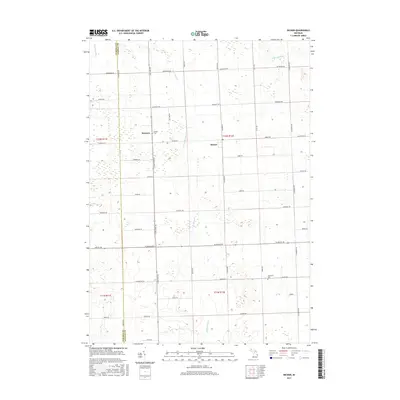
2017 Map of Decker
USGS Topo · Published 2017About this map
Decker and Hemans anchor this portion of the Thumb region, where the border between Tuscola County and Sanilac County creates a sharp jurisdictional divide through the agricultural landscape. The area is defined by a rigorous grid of section-line roads, including Mushroom Rd, Van Dyke Rd, and Sanilac Rd, which facilitate the movement of local crops and livestock. Water management is a primary feature of the terrain, with the McCallum Drain and Hillaker Drain supplementing natural courses like the S Br Cass River and the N Br White Cr. For those researching local families, the presence of Moshier Cem and Germania Cem provides essential grounding in the community's ancestral history, reflecting the established rural settlements that have persisted through over a century of Michigan's farming tradition.
Find a feature on this map
52 named features on this map. Tap any name to fly to it.
Don’t see what you’re looking for? This feature index may not catch every label — zoom into the map to look around manually.
Map Details
Editions of this 2017 Decker Map
This is the sole edition of this map. No revisions or reprints were ever made.
Other maps of this area

1954 · Flint
USGS Topo · 1:250,000

1958 · Flint
USGS Topo · 1:250,000

1963 · Snover
USGS Topo · 1:24,000

1963 · Clifford
USGS Topo · 1:24,000

1963 · Juhl
USGS Topo · 1:24,000

1963 · Marlette
USGS Topo · 1:24,000

1963 · Kingston
USGS Topo · 1:24,000

1963 · Cass City
USGS Topo · 1:24,000

1963 · Shabbona
USGS Topo · 1:24,000
1963 · Decker
USGS Topo · 1:24,000