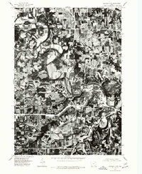
1975 Map of Decorah 2 SE
USGS Topo · Published 1977About this map
The Upper Iowa River winds through this 1975 orthophotoquad, carving deep loops through the landscape of Winneshiek County. This specialized aerial-based map, produced by the U.S. Geological Survey and the Iowa Geological Survey, provides a precise visual record of land use and vegetation patterns during the mid-1970s. The settlement of Decorah is clearly visible, showing the concentrated development of the town at a significant bend in the river. Beyond the town limits, the map reveals a complex patchwork of agricultural fields and wooded bluffs. The orthophoto format is particularly valuable for researchers tracing historical field boundaries, woodlots, and the exact footprint of farmsteads as they existed decades ago, offering a literal view of the terrain that standard topographic lines cannot convey.
Find a feature on this map
2 named features on this map. Tap any name to fly to it.
Don’t see what you’re looking for? This feature index may not catch every label — zoom into the map to look around manually.
Map Details
Editions of this 1975 Decorah 2 SE Map
This is the sole edition of this map. No revisions or reprints were ever made.
Other maps of this area

1906 · Decorah
USGS Topo · 1:125,000

1958 · La Crosse
USGS Topo · 1:250,000

1961 · La Crosse
USGS Topo · 1:250,000

1965 · La Crosse
USGS Topo · 1:250,000

1975 · Decorah 4 NW
USGS Topo · 1:24,000

1975 · Decorah 1 NW
USGS Topo · 1:24,000

1975 · Decorah 2 NW
USGS Topo · 1:24,000

1975 · Decorah 1 SW
USGS Topo · 1:24,000

1975 · Decorah 3 NW
USGS Topo · 1:24,000
1975 · Decorah 2 NE
USGS Topo · 1:24,000