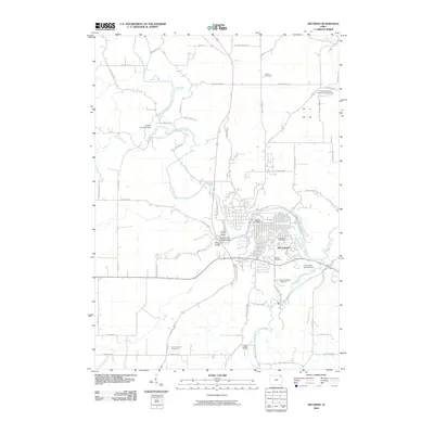
2010 Map of Decorah
USGS Topo · Published 2010About this map
The Upper Iowa River snakes through the heart of this landscape, defining the topography of Decorah and its surrounding countryside. In the northwest, the river's path is marked by landmarks like Malanaphy Springs and Sutton Landing Strip, while its southern reaches are characterized by numerous tributaries including Trout Run and Trout Creek. The town itself is a concentration of civic and social history, centered on the Decorah Post Office and bordered by significant burial grounds such as Lutheran Cemetery and Phelps Cemetery.
Find a feature on this map
61 named features on this map. Tap any name to fly to it.
Don’t see what you’re looking for? This feature index may not catch every label — zoom into the map to look around manually.
Map Details
Editions of this 2010 Decorah Map
This is the sole edition of this map. No revisions or reprints were ever made.
Other maps of this area

1906 · Decorah
USGS Topo · 1:125,000

1958 · La Crosse
USGS Topo · 1:250,000

1961 · La Crosse
USGS Topo · 1:250,000

1965 · La Crosse
USGS Topo · 1:250,000

1975 · Decorah 4 NW
USGS Topo · 1:24,000

1975 · Decorah 1 NW
USGS Topo · 1:24,000

1975 · Decorah 2 NW
USGS Topo · 1:24,000

1975 · Decorah 1 SW
USGS Topo · 1:24,000

1975 · Decorah 3 NW
USGS Topo · 1:24,000
1975 · Decorah 2 NE
USGS Topo · 1:24,000