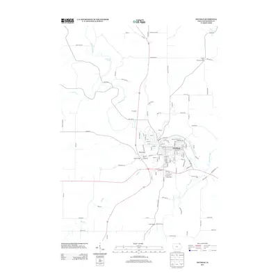
2013 Map of Decorah
USGS Topo · Published 2013About this map
Upper Iowa River bends sharply through the heart of this Winneshiek County landscape, defining the layout of Decorah. The town's grid is constrained by the river's winding course, with notable crossings such as Steyer Bridge and the namesake Ice Cave Rd reflecting the local geography. Beyond the residential streets of E Broadway St and Winneshiek Ave, the terrain rises toward significant landmarks like the Pulpit Rock formation and Malanaphy Springs to the northwest.
Find a feature on this map
108 named features on this map. Tap any name to fly to it.
Don’t see what you’re looking for? This feature index may not catch every label — zoom into the map to look around manually.
Map Details
Editions of this 2013 Decorah Map
This is the sole edition of this map. No revisions or reprints were ever made.
Other maps of this area

1906 · Decorah
USGS Topo · 1:125,000

1958 · La Crosse
USGS Topo · 1:250,000

1961 · La Crosse
USGS Topo · 1:250,000

1965 · La Crosse
USGS Topo · 1:250,000

1975 · Decorah 4 NW
USGS Topo · 1:24,000

1975 · Decorah 1 NW
USGS Topo · 1:24,000

1975 · Decorah 2 NW
USGS Topo · 1:24,000

1975 · Decorah 1 SW
USGS Topo · 1:24,000

1975 · Decorah 3 NW
USGS Topo · 1:24,000
1975 · Decorah 2 NE
USGS Topo · 1:24,000