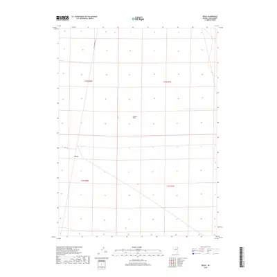
2018 Map of Decoy
USGS Topo · Published 2018About this map
Goshute Valley dominates this high-desert landscape in Elko County, where the topography is defined by the vast, open basin floor. The settlement of Decoy stands as a focal point in the southwestern portion of the sheet, connected to the wider region by Decoy Rd. The map reveals a sparse infrastructure typical of the Great Basin, where land management and transportation are primarily facilitated by utility routes like RR Maintenance Rd. Surveyed in the 21st century, the map uses township and range boundaries—including t33n r66e and t32n r67e—to organize a terrain where water and prominent landmarks are few, emphasizing the isolation of rural Nevada outposts.
Find a feature on this map
8 named features on this map. Tap any name to fly to it.
Don’t see what you’re looking for? This feature index may not catch every label — zoom into the map to look around manually.
Map Details
Editions of this 2018 Decoy Map
This is the sole edition of this map. No revisions or reprints were ever made.
Other maps of this area

1953 · Spruce Mountain 4
USGS Topo · 1:62,500

1955 · Elko
USGS Topo · 1:250,000

1958 · Elko
USGS Topo · 1:250,000

1962 · Elko
USGS Topo · 1:250,000

1965 · Elko
USGS Topo · 1:250,000

1968 · Independence Valley SE
USGS Topo · 1:24,000

1971 · West Morris Basin
USGS Topo · 1:24,000

1971 · Shafter
USGS Topo · 1:24,000

1971 · Decoy
USGS Topo · 1:24,000

1972 · Morgan Pass
USGS Topo · 1:24,000