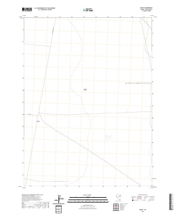
2021 Map of Decoy
USGS Topo · Published 2021About this map
Goshute Valley defines this stretch of Elko County, Nevada, where the high desert landscape is etched with the markers of utility and transport. The small settlement of Decoy sits along Decoy Rd, serving as a waypoint in an area primarily organized by the Public Land Survey System, as evidenced by the grid of township boundaries including t33n r66e and t32n r67e. The presence of the RR Maintenance Rd running through the northern sections highlights the vital role of transit infrastructure in this remote corridor, where land management and right-of-way access are central to the local geography. This survey provides a precise look at the drainage patterns and township divisions within the valley floor during the early 21st century.
Find a feature on this map
8 named features on this map. Tap any name to fly to it.
Don’t see what you’re looking for? This feature index may not catch every label — zoom into the map to look around manually.
Map Details
Editions of this 2021 Decoy Map
This is the sole edition of this map. No revisions or reprints were ever made.
Other maps of this area

1953 · Spruce Mountain 4
USGS Topo · 1:62,500

1955 · Elko
USGS Topo · 1:250,000

1958 · Elko
USGS Topo · 1:250,000

1962 · Elko
USGS Topo · 1:250,000

1965 · Elko
USGS Topo · 1:250,000

1968 · Independence Valley SE
USGS Topo · 1:24,000

1971 · West Morris Basin
USGS Topo · 1:24,000

1971 · Shafter
USGS Topo · 1:24,000

1971 · Decoy
USGS Topo · 1:24,000

1972 · Morgan Pass
USGS Topo · 1:24,000