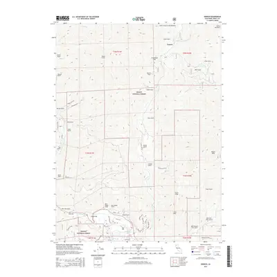
2015 Map of Dedrick
USGS Topo · Published 2015About this map
Dedrick stands as a focal point within the high country of the Trinity National Forest, situated near the headwaters of Canyon Creek. This 2015 survey illustrates a landscape deeply shaped by water and elevation, from the Salmon Mountains in the north to the Trinity River corridor in the south. The prevalence of named bars along the river, such as Coopers Bar and Idaho Bar, suggests a history of riverside activity and gravel deposits. The southern portion of the map reveals clusters of small settlements and local roads, including West Valdor Gulch, East Valdor Gulch, and Red Hill. Transportation in these high ridges is defined by named forest routes like Cemetery Rd and Conrad Gulch Rd, which navigate the steep drainages between prominent peaks like Weaver Bally and Little Bally. To the north, the terrain opens into Lower Canyon Creek Meadows, surrounded by numerous named gulches and flats.
Find a feature on this map
65 named features on this map. Tap any name to fly to it.
Don’t see what you’re looking for? This feature index may not catch every label — zoom into the map to look around manually.
Map Details
Editions of this 2015 Dedrick Map
This is the sole edition of this map. No revisions or reprints were ever made.
Other maps of this area

1890 · Red Bluff
USGS Topo · 1:250,000

1894 · Red Bluff
USGS Topo · 1:250,000

1909 · Big Bar
USGS Topo · 1:96,000

1913 · Weaverville
USGS Topo · 1:125,000

1915 · Big Bar and Vicinity
USGS Topo · 1:250,000

1950 · Minersville
USGS Topo · 1:62,500

1950 · Weaverville
USGS Topo · 1:62,500

1951 · Hayfork
USGS Topo · 1:62,500

1951 · Helena
USGS Topo · 1:62,500

1952 · Weaverville
USGS Topo · 1:62,500