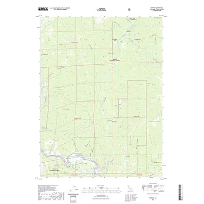
2022 Map of Dedrick
USGS Topo · Published 2022About this map
Canyon Cr and the Trinity Wild and Scenic River define the drainage patterns of this high-elevation landscape within the Trinity National Forest. The map centers on the small settlement of Dedrick, situated near the confluence of Canyon Cr and Little E Fork Canyon Cr. This area is characterized by steep gulches and high peaks, including Salmon Mountains and Weaver Bally, reflecting a topography deeply shaped by historic mining and water management.
Find a feature on this map
65 named features on this map. Tap any name to fly to it.
Don’t see what you’re looking for? This feature index may not catch every label — zoom into the map to look around manually.
Map Details
Editions of this 2022 Dedrick Map
This is the sole edition of this map. No revisions or reprints were ever made.
Other maps of this area

1890 · Red Bluff
USGS Topo · 1:250,000

1894 · Red Bluff
USGS Topo · 1:250,000

1909 · Big Bar
USGS Topo · 1:96,000

1913 · Weaverville
USGS Topo · 1:125,000

1915 · Big Bar and Vicinity
USGS Topo · 1:250,000

1950 · Minersville
USGS Topo · 1:62,500

1950 · Weaverville
USGS Topo · 1:62,500

1951 · Hayfork
USGS Topo · 1:62,500

1951 · Helena
USGS Topo · 1:62,500

1952 · Weaverville
USGS Topo · 1:62,500