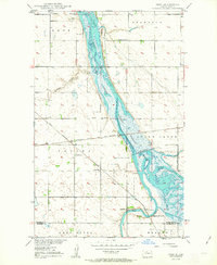
1950 Map of Deep
USGS Topo · Published 1963About this map
The Lower Souris National Wildlife Refuge dominates this landscape along the border of Bottineau and McHenry Counties, following the winding course of the Souris River. This mid-century survey captures a region defined by its water management and agricultural infrastructure, featuring water control structures like Dam No 332 and various spillways that manage the marshlands. The prairie townships of Kane, Starbuck, and Tacoma are dotted with the essential landmarks of rural life, including St Johns Ch, Lutheran Ch, and a local Town Hall.
Find a feature on this map
26 named features on this map. Tap any name to fly to it.
Don’t see what you’re looking for? This feature index may not catch every label — zoom into the map to look around manually.
Map Details
Editions of this 1950 Deep Map
2 editions found
Other maps of this area

1948 · Newburg SW
USGS Topo · 1:24,000

1949 · Newburg SW
USGS Topo · 1:24,000

1949 · Landa SW
USGS Topo · 1:24,000

1949 · Kramer
USGS Topo · 1:24,000

1950 · Newburg
USGS Topo · 1:24,000

1950 · Kramer
USGS Topo · 1:24,000

1950 · Deep
USGS Topo · 1:24,000

1950 · Upham
USGS Topo · 1:24,000

1950 · Newburg SE
USGS Topo · 1:24,000

1950 · Landa SW
USGS Topo · 1:24,000