
1950 Map of Deep
USGS Topo · Published 1950About this map
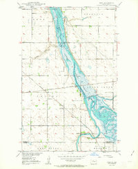
The Lower Souris National Wildlife Refuge dominates this mid-century landscape in Bottineau and McHenry Counties, following the winding course of the Souris River through the glacial plains. This area is a critical junction of transport and community life, where the Great Northern and the Minneapolis St Paul and Sault Ste Marie railroads intersect near the small settlement of Deep. The map reveals the civic fabric of rural North Dakota during the post-war era, documenting the locations of the Town Hall and local educational hubs like Thrums Sch No 1 and Deep Sch. Religious life is anchored by St Johns Ch and the Lutheran Ch, while the hydrological character is defined by the Deep River and Stone Creek as they drain into the expansive refuge wetlands.
Find a feature on this map
23 named features on this map. Tap any name to fly to it.
Don’t see what you’re looking for? This feature index may not catch every label — zoom into the map to look around manually.
Map Details
Editions of this 1950 Deep Map
2 editions found
Other maps of this area

1948 · Newburg SW
USGS Topo · 1:24,000

1949 · Newburg SW
USGS Topo · 1:24,000

1949 · Landa SW
USGS Topo · 1:24,000

1949 · Kramer
USGS Topo · 1:24,000

1950 · Newburg
USGS Topo · 1:24,000

1950 · Kramer
USGS Topo · 1:24,000

1950 · Upham
USGS Topo · 1:24,000

1950 · Newburg SE
USGS Topo · 1:24,000

1950 · Landa SW
USGS Topo · 1:24,000

1954 · Souris SW
USGS Topo · 1:24,000