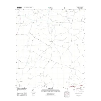
2012 Map of Deep Creek
USGS Topo · Published 2012About this map
Deep Creek and the surrounding woodlands of northern Florida are defined by a complex network of waterways and service roads used for timber management and outdoor recreation. The namesake Deep Cr winds through the northern half of the landscape, joined by tributaries such as Little Br and Caney Flat Br. Small settlements like Greenfield and the West Tower Hunt Camp suggest a rural character centered on forestry and traditional land use.
Find a feature on this map
32 named features on this map. Tap any name to fly to it.
Don’t see what you’re looking for? This feature index may not catch every label — zoom into the map to look around manually.
Map Details
Editions of this 2012 Deep Creek Map
This is the sole edition of this map. No revisions or reprints were ever made.
Other maps of this area

1954 · Valdosta
USGS Topo · 1:250,000

1958 · Valdosta
USGS Topo · 1:250,000

1959 · Valdosta
USGS Topo · 1:250,000

1961 · Deep Creek
USGS Topo · 1:24,000

1961 · White Springs East
USGS Topo · 1:24,000

1962 · Lake City East
USGS Topo · 1:24,000

1963 · Olustee
USGS Topo · 1:24,000

1963 · Lake City West
USGS Topo · 1:24,000

1969 · Sanderson NW
USGS Topo · 1:24,000
1969 · Benton
USGS Topo · 1:24,000