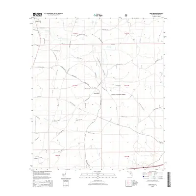
2015 Map of Deep Creek
USGS Topo · Published 2015About this map
Osceola National Forest defines the eastern and southern reaches of this landscape, where a dense network of specialized trails crisscrosses the timberlands. The area is characterized by low-lying wetlands and drainage systems, including Deep Creek, Caney Flat Br, and Robinson Cr, which feed through the forest. The small settlement of Greenfield sits at a junction of forest roads, while the community of Deep Creek is situated in the northwest corner near the water body that bears its name. The trail system is remarkably specific, with the Florida National Scenic Trail and the FNST - Osceola Section sharing space with color-coded equestrian or hiking routes like the Green Horse Trail and Blue Horse Trail. This concentration of recreational paths within the managed forest indicates the modern era's emphasis on public land use for outdoor recreation alongside traditional timber management.
Find a feature on this map
41 named features on this map. Tap any name to fly to it.
Don’t see what you’re looking for? This feature index may not catch every label — zoom into the map to look around manually.
Map Details
Editions of this 2015 Deep Creek Map
This is the sole edition of this map. No revisions or reprints were ever made.
Other maps of this area

1954 · Valdosta
USGS Topo · 1:250,000

1958 · Valdosta
USGS Topo · 1:250,000

1959 · Valdosta
USGS Topo · 1:250,000

1961 · Deep Creek
USGS Topo · 1:24,000

1961 · White Springs East
USGS Topo · 1:24,000

1962 · Lake City East
USGS Topo · 1:24,000

1963 · Olustee
USGS Topo · 1:24,000

1963 · Lake City West
USGS Topo · 1:24,000

1969 · Sanderson NW
USGS Topo · 1:24,000
1969 · Benton
USGS Topo · 1:24,000