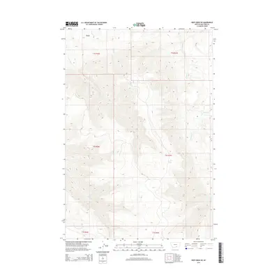
2014 Map of Deep Creek SW
USGS Topo · Published 2014About this map
Lost Creek Spring and the high-elevation basin of Crater Lake define the complex drainage systems of this Big Horn County landscape. The mapping of Smallpox Cr and Lost Cr reveals a terrain where water management is critical, evidenced by the Lost Cr Ditch cutting through the northwestern sections. This 2014 survey captures a network of tributaries including Middle Cr, Hay Cr, and Shively Cr that eventually feed into the larger Pryor Cr system. The detailed contour work illustrates the significant elevation changes between the creek beds and the surrounding ridges, providing a clear view of the natural hydrology and land divisions across various townships, from t5s r26e down to the southern reaches of t7s r27e.
Find a feature on this map
16 named features on this map. Tap any name to fly to it.
Don’t see what you’re looking for? This feature index may not catch every label — zoom into the map to look around manually.
Map Details
Editions of this 2014 Deep Creek SW Map
This is the sole edition of this map. No revisions or reprints were ever made.
Other maps of this area

1954 · Billings
USGS Topo · 1:250,000

1957 · Billings
USGS Topo · 1:250,000

1958 · Billings
USGS Topo · 1:250,000

1964 · Big Ice Cave
USGS Topo · 1:24,000

1964 · East Pryor Mountain
USGS Topo · 1:24,000

1967 · Deep Creek SE
USGS Topo · 1:24,000

1967 · Castle Rocks
USGS Topo · 1:24,000

1967 · Deep Creek
USGS Topo · 1:24,000

1967 · Pryor
USGS Topo · 1:24,000

1967 · Deep Creek SW
USGS Topo · 1:24,000