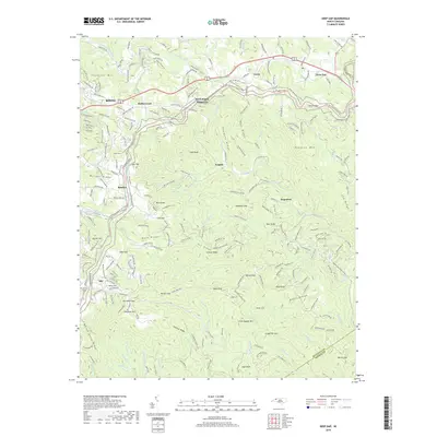
2019 Map of Deep Gap
USGS Topo · Published 2019About this map
Deep Gap serves as a prominent landmark on this high-elevation portion of the Blue Ridge, where the Eastern Continental Divide separates the headwaters of the South Fork New River from the Atlantic-bound Elk Creek. The landscape is defined by its varied topography, featuring numerous named knobs and gaps such as Deadman Gap, Grassy Knob, and Horton Gap. Settlements like Rutherwood, Triplett, and Bamboo are connected by a network of winding mountain roads, including segments of the Blue Ridge Parkway and the historic Old US Highway 421 S. The proximity of Boone on the western edge of the sheet reflects the region's development as an educational and cultural hub. Genealogical interest is centered around local landmarks like the Laurel Fork Cemetery near Aho and family-named features such as Pasleys Ridge and Bens Ridge that characterize the area's rural history.
Find a feature on this map
221 named features on this map. Tap any name to fly to it.
Don’t see what you’re looking for? This feature index may not catch every label — zoom into the map to look around manually.
Map Details
Editions of this 2019 Deep Gap Map
This is the sole edition of this map. No revisions or reprints were ever made.
Other maps of this area

1889 · Wilkesboro
USGS Topo · 1:125,000

1891 · Wilkesboro
USGS Topo · 1:125,000

1893 · Cranberry
USGS Topo · 1:125,000

1895 · Cranberry
USGS Topo · 1:125,000

1899 · Cranberry
USGS Topo · 1:125,000

1902 · Cranberry
USGS Topo · 1:125,000

1934 · Boone
USGS Topo · 1:24,000

1935 · Zionville
USGS Topo · 1:24,000

1936 · Blowing Rock
USGS Topo · 1:48,000
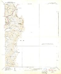
1939 · Zionville
USGS Topo · 1:24,000