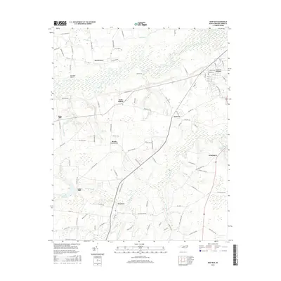
2016 Map of Deep Run
USGS Topo · Published 2016About this map
The Neuse River meanders across this rural Lenoir County landscape, defining the northern geography near Bucklesberry and the recreational area of Pine Bush Beach. This 2016 survey captures a network of small, established communities and agricultural intersections, including Blands Crossroads, Sandy Bottom, and Albrittons. The southern portion of the map is dominated by the namesake community of Deep Run, situated near the confluence of Toms Br and Deep Run.
Find a feature on this map
101 named features on this map. Tap any name to fly to it.
Don’t see what you’re looking for? This feature index may not catch every label — zoom into the map to look around manually.
Map Details
Editions of this 2016 Deep Run Map
This is the sole edition of this map. No revisions or reprints were ever made.
Other maps of this area

1914 · Kinston
USGS Topo · 1:48,000

1916 · Kinston
USGS Topo · 1:62,500

1953 · Rocky Mount
USGS Topo · 1:250,000

1954 · Rocky Mount
USGS Topo · 1:250,000

1957 · Goldsboro
USGS Topo · 1:62,500

1957 · Seven Springs
USGS Topo · 1:62,500

1958 · Deep Run
USGS Topo · 1:62,500

1980 · Seven Springs
USGS Topo · 1:24,000
1980 · Pink Hill
USGS Topo · 1:24,000
1980 · Deep Run
USGS Topo · 1:24,000