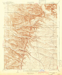
1931 Map of Deepwell Ranch
USGS Topo · Published 1942About this map
Deepwell Ranch sits at the center of this landscape surveyed in the late 1920s, a period when Kern County’s foothills were defined by large landholdings and early infrastructure. The map illustrates a transitional terrain where ephemeral watercourses like Dyer Creek carve through the topography, flanked by the Hodgeman Ranch to the north and Villards to the east. A prominent Transmission Line cuts nearly vertically through the center of the sheet, signaling the era's growing utility network and modernization of the rural interior. The principal artery of movement is the Mc Farland Woody Road, which snakes through the southern half of the quadrangle. This layout reflects the early development of the region before the expansion of mid-century industrial agriculture, preserving the locations of specific ranch houses and primitive routes that have since been altered or bypassed by modern highways.
Find a feature on this map
6 named features on this map. Tap any name to fly to it.
Don’t see what you’re looking for? This feature index may not catch every label — zoom into the map to look around manually.
Map Details
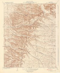
Editions of this 1931 Deepwell Ranch Map
3 editions found
Other maps of this area

1906 · Bakersfield
USGS Topo · 1:62,500

1926 · Quincy School
USGS Topo · 1:31,680

1927 · McFarland
USGS Topo · 1:31,680

1929 · Delano
USGS Topo · 1:31,680

1929 · Richgrove
USGS Topo · 1:31,680

1929 · Quincy School
USGS Topo · 1:31,680

1930 · McFarland
USGS Topo · 1:31,680

1930 · Famoso
USGS Topo · 1:31,680

1931 · Deepwell Ranch
USGS Topo · 1:31,680

1932 · North of Oildale
USGS Topo · 1:31,680