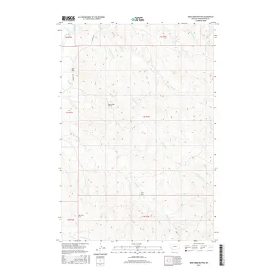
2017 Map of Deer Creek Buttes
USGS Topo · Published 2017About this map
Deer Creek Buttes anchors this landscape in eastern Montana, where the terrain is defined by a dense network of seasonal drainages and sharp relief. The western edge of the map is bordered by the Powder River, a historical artery of the region, while the interior is cut by numerous creek forks including the N Fork Horse Cr and S Fork Horse Cr. The presence of established routes like Powderville Rd and Moore Rd indicates long-standing connectivity through this section of Powder River County. The map provides a detailed view of the local topography, highlighting named features such as Wolf Draw, Strock Draw, and the curiously named Poker Jim Gulch. These labels offer a glimpse into the naming conventions and local history of the ranchers and early settlers who navigated these draws and creek beds.
Find a feature on this map
20 named features on this map. Tap any name to fly to it.
Don’t see what you’re looking for? This feature index may not catch every label — zoom into the map to look around manually.
Map Details
Editions of this 2017 Deer Creek Buttes Map
This is the sole edition of this map. No revisions or reprints were ever made.
Other maps of this area

1954 · Ekalaka
USGS Topo · 1:250,000

1956 · Ekalaka
USGS Topo · 1:250,000

1958 · Ekalaka
USGS Topo · 1:250,000

1965 · Ekalaka
USGS Topo · 1:250,000

1973 · Cross S School
USGS Topo · 1:24,000

1973 · Monday Creek
USGS Topo · 1:24,000

1973 · Hawkey Creek
USGS Topo · 1:24,000

1979 · Deer Creek Buttes
USGS Topo · 1:24,000

1979 · Rattlesnake Ridge
USGS Topo · 1:24,000
1979 · Oliphant Butte
USGS Topo · 1:24,000