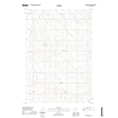
2020 Map of Deer Creek Buttes
USGS Topo · Published 2020About this map
Deer Creek Buttes stand as the central landmarks in this high-plains landscape of Powder River County. The area is defined by a dense network of seasonal drainages and coulees, including Wolf Draw, Strock Draw, and the winding Poker Jim Gulch. These landforms dictate the local movement of water toward the Powder River, which clips the northwestern corner of the map. Transportation in this sparsely populated region is dominated by the Powderville Rd, a primary corridor that follows the terrain's natural contours. The hydrology is particularly complex in the northern sections, where the N Fork Horse Cr and S Fork Horse Cr converge. This map reflects a landscape primarily utilized for ranching and open range, where the few named roads and geographic features like Poker Jim Cr provide the essential orientation points for the vast intervals of eastern Montana.
Find a feature on this map
21 named features on this map. Tap any name to fly to it.
Don’t see what you’re looking for? This feature index may not catch every label — zoom into the map to look around manually.
Map Details
Editions of this 2020 Deer Creek Buttes Map
This is the sole edition of this map. No revisions or reprints were ever made.
Other maps of this area

1954 · Ekalaka
USGS Topo · 1:250,000

1956 · Ekalaka
USGS Topo · 1:250,000

1958 · Ekalaka
USGS Topo · 1:250,000

1965 · Ekalaka
USGS Topo · 1:250,000

1973 · Cross S School
USGS Topo · 1:24,000

1973 · Monday Creek
USGS Topo · 1:24,000

1973 · Hawkey Creek
USGS Topo · 1:24,000

1979 · Deer Creek Buttes
USGS Topo · 1:24,000

1979 · Rattlesnake Ridge
USGS Topo · 1:24,000
1979 · Oliphant Butte
USGS Topo · 1:24,000