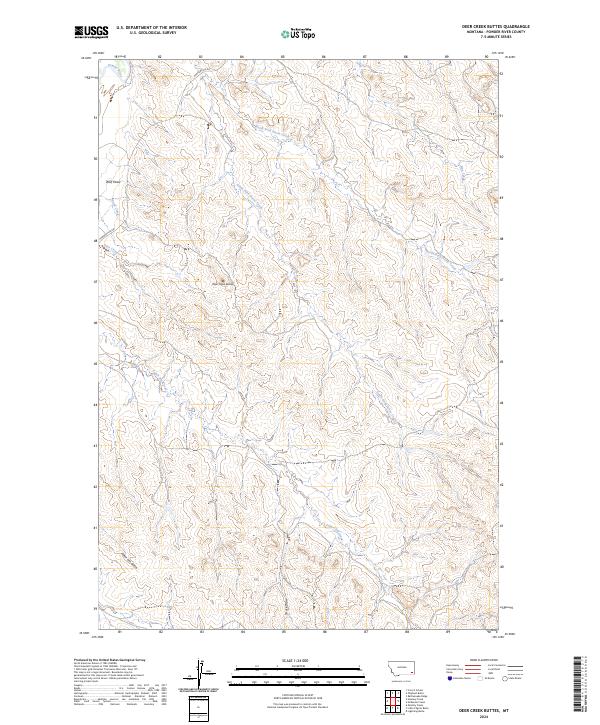
2024 Map of Deer Creek Buttes
USGS Topo · Published 2024About this map
The Deer Creek Buttes rise above a landscape defined by the intricate drainage systems of the Powder River basin in this remote section of southeastern Montana. Surveyed in the 2020s, the map reveals a terrain deeply etched by seasonal waterways including the North Fork Horse Creek, South Fork Horse Creek, and Poker Jim Creek. These watercourses create a complex network of draws and gulches, such as Wolf Draw and Poker Jim Gulch, which dictate the local topography. Human infrastructure is limited to the winding path of Powderville Rd in the northwest, suggesting a sparsely populated ranching or grazing region. The dominance of natural landmarks like Deer Creek and Stock Draw highlights the enduring character of this portion of Powder River County, where the land remains largely defined by its hydrology and landform features rather than dense settlement.
Find a feature on this map
18 named features on this map. Tap any name to fly to it.
Don’t see what you’re looking for? This feature index may not catch every label — zoom into the map to look around manually.
Map Details
Editions of this 2024 Deer Creek Buttes Map
This is the sole edition of this map. No revisions or reprints were ever made.
Other maps of this area

1954 · Ekalaka
USGS Topo · 1:250,000

1956 · Ekalaka
USGS Topo · 1:250,000

1958 · Ekalaka
USGS Topo · 1:250,000

1965 · Ekalaka
USGS Topo · 1:250,000

1973 · Cross S School
USGS Topo · 1:24,000

1973 · Monday Creek
USGS Topo · 1:24,000

1973 · Hawkey Creek
USGS Topo · 1:24,000

1979 · Deer Creek Buttes
USGS Topo · 1:24,000

1979 · Rattlesnake Ridge
USGS Topo · 1:24,000
1979 · Oliphant Butte
USGS Topo · 1:24,000