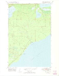
1948 Map of Deer Lake
USGS Topo · Published 1974About this map
Betsy River Sch sits near the rocky shoreline of the Keweenaw Peninsula, reflecting a time when isolated coastal schools served the scattered residents of Grant and Sherman townships. This 1948 field check captures the area just as modern infrastructure began to reach these northern reaches, specifically noted by the roadway marked Under Construction stretching along the coast toward Black Rock Point. The landscape is defined by its complex hydrology, where the Little Gratiot River connects Lake Gratiot to the smaller Deer Lake, while the Big Betsy River and Little Betsy River carve through the timberlands before emptying into Betsy Bay. The map provides a detailed view of the terrain transitioning from the inland waters of Lac La Belle to the vast expanse of Lake Superior.
Find a feature on this map
18 named features on this map. Tap any name to fly to it.
Don’t see what you’re looking for? This feature index may not catch every label — zoom into the map to look around manually.
Map Details
Editions of this 1948 Deer Lake Map
3 editions found
Other maps of this area

1927 · Point Isabelle
USGS Topo · 1:31,680

1938 · Bruneau Creek
USGS Topo · 1:31,680

1938 · Gay
USGS Topo · 1:31,680

1938 · Delaware
USGS Topo · 1:31,680

1939 · Deer Lake
USGS Topo · 1:31,680

1939 · Delaware
USGS Topo · 1:31,680

1940 · Deer Lake
USGS Topo · 1:31,680

1940 · Central
USGS Topo · 1:31,680

1940 · Lake Medora
USGS Topo · 1:31,680

1946 · Bruneau Creek
USGS Topo · 1:24,000