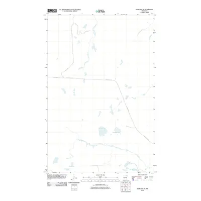
2010 Map of Deer Lake NE
USGS Topo · Published 2010About this map
Valley River winds through this northern Minnesota landscape, defining the local hydrology alongside several glacial lakes. This 2010 survey shows a network of remote water bodies including Franklin Lake, Pocquette Lake, and Candy Lake, which suggest the area's use for seasonal recreation and timber management. The transportation network is sparse, centered on Kendall Rd and Holstrum Rd, with the Holstrum Spur Trl cutting across the central terrain. Gardner Brook feeds into the northern portion of the quadrangle, illustrating the complex wetland and river systems typical of Itasca County. Small, named lakes like Hope Lake and Lost Lake provide specific points of interest for local history researchers tracing property boundaries or early hunting and fishing camps in the region.
Find a feature on this map
11 named features on this map. Tap any name to fly to it.
Don’t see what you’re looking for? This feature index may not catch every label — zoom into the map to look around manually.
Map Details
Editions of this 2010 Deer Lake NE Map
This is the sole edition of this map. No revisions or reprints were ever made.
Other maps of this area

1954 · Hibbing
USGS Topo · 1:250,000

1954 · International Falls
USGS Topo · 1:250,000

1957 · Hibbing
USGS Topo · 1:250,000

1957 · International Falls
USGS Topo · 1:250,000

1958 · International Falls
USGS Topo · 1:250,000

1958 · Hibbing
USGS Topo · 1:250,000

1964 · Hibbing
USGS Topo · 1:250,000

1970 · Rauch
USGS Topo · 1:24,000

1970 · Nett Lake River SE
USGS Topo · 1:24,000

1970 · Deer Lake East
USGS Topo · 1:24,000