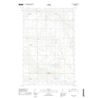
2019 Map of Deer Lake NE
USGS Topo · Published 2019About this map
The Koochiching Co and Itasca Co border divides this Northern Minnesota landscape, a region defined by its complex network of waterways and wetlands. The Valley River meanders across the southern portion of the sheet, connecting several remote water bodies including Franklin Lake, Pocquette Lake, and Harrigan Lake. This 2019 survey shows a terrain largely managed for timber and conservation, where narrow routes like Holstrum Rd and the Holstrum Spur Trl provide the primary access into the interior. These roads trace the higher ground between basins like Candy Lake and Lost Lake, illustrating the challenge of navigating the boggy stretches of the north woods. The drainage patterns are further marked by Gardner Brook, which flows through the northern townships, highlighting the hydrologic connectivity that has shaped this corner of the state.
Find a feature on this map
19 named features on this map. Tap any name to fly to it.
Don’t see what you’re looking for? This feature index may not catch every label — zoom into the map to look around manually.
Map Details
Editions of this 2019 Deer Lake NE Map
This is the sole edition of this map. No revisions or reprints were ever made.
Other maps of this area

1954 · Hibbing
USGS Topo · 1:250,000

1954 · International Falls
USGS Topo · 1:250,000

1957 · Hibbing
USGS Topo · 1:250,000

1957 · International Falls
USGS Topo · 1:250,000

1958 · International Falls
USGS Topo · 1:250,000

1958 · Hibbing
USGS Topo · 1:250,000

1964 · Hibbing
USGS Topo · 1:250,000

1970 · Rauch
USGS Topo · 1:24,000

1970 · Nett Lake River SE
USGS Topo · 1:24,000

1970 · Deer Lake East
USGS Topo · 1:24,000