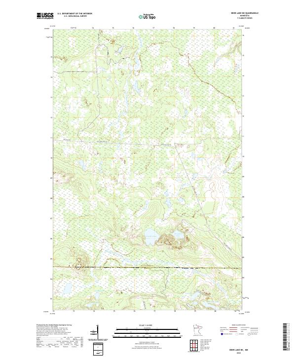
2022 Map of Deer Lake NE
USGS Topo · Published 2022About this map
Gardner Brook and the Valley River weave through this section of the Minnesota Northwoods, which straddles the border of Koochiching and Itasca counties. This remote landscape is defined by its extensive wetlands and numerous small bodies of water, including Franklin Lake, Poquette Lake, and Candy Lake. The presence of the Holstrum Rd and the Holstrum Spur Trl suggests a network of logging or forest access routes that have likely been used for decades to navigate this low-lying terrain. To the south, Harrigan Lake and Hope Lake sit among a series of subtle ridges and hollows, providing a look at the natural drainage patterns that dominate the region. The map captures the quiet character of the wilderness before the more developed areas to the south and west.
Find a feature on this map
19 named features on this map. Tap any name to fly to it.
Don’t see what you’re looking for? This feature index may not catch every label — zoom into the map to look around manually.
Map Details
Editions of this 2022 Deer Lake NE Map
This is the sole edition of this map. No revisions or reprints were ever made.
Other maps of this area

1954 · Hibbing
USGS Topo · 1:250,000

1954 · International Falls
USGS Topo · 1:250,000

1957 · Hibbing
USGS Topo · 1:250,000

1957 · International Falls
USGS Topo · 1:250,000

1958 · International Falls
USGS Topo · 1:250,000

1958 · Hibbing
USGS Topo · 1:250,000

1964 · Hibbing
USGS Topo · 1:250,000

1970 · Rauch
USGS Topo · 1:24,000

1970 · Nett Lake River SE
USGS Topo · 1:24,000

1970 · Deer Lake East
USGS Topo · 1:24,000