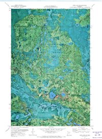
1970 Map of Deer Lake NE
USGS Topo · Published 1973About this map
Koochiching State Forest and George Washington State Forest converge in this northern Minnesota landscape, creating a dense mosaic of woodland and wetlands. The orthophotomap format provides a direct view of the boggy terrain and lake networks during the early 1970s, highlighting the isolation and natural character of the region.
Find a feature on this map
12 named features on this map. Tap any name to fly to it.
Don’t see what you’re looking for? This feature index may not catch every label — zoom into the map to look around manually.
Map Details
Editions of this 1970 Deer Lake NE Map
This is the sole edition of this map. No revisions or reprints were ever made.
Other maps of this area

1954 · Hibbing
USGS Topo · 1:250,000

1954 · International Falls
USGS Topo · 1:250,000

1957 · Hibbing
USGS Topo · 1:250,000

1957 · International Falls
USGS Topo · 1:250,000

1958 · International Falls
USGS Topo · 1:250,000

1958 · Hibbing
USGS Topo · 1:250,000

1964 · Hibbing
USGS Topo · 1:250,000

1970 · Rauch
USGS Topo · 1:24,000

1970 · Nett Lake River SE
USGS Topo · 1:24,000

1970 · Deer Lake East
USGS Topo · 1:24,000